NSF CIVIC
CIVIC-PG Track B: Bridging the Gap between Essential Emergency Resources and Services and the Deaf and Hard of Hearing Community in Monroe County NY: A Geospatial-Visual Approach
This Civic Innovation Challenge (CIVIC) project is a vision to identify and bridge specific gaps in essential emergency resources and services for the Deaf and Hard-of-Hearing (DHH) community in Monroe County, New York. Situated within Monroe County, Rochester New York is home to the largest per capita population of DHH people in the US. Stage 1 pilot project activities will be undertaken between three partners - (1) the Rochester Institute of Technology and the National Technical Institute of the Deaf, (2) the Monroe County Office of Emergency Management, and (3) the Rochester Recreation Club for Deaf. The project represents a unique coupling of academic research with the DHH community and emergency management. Project goals include identifying DHH community emergency service gaps, creating and evaluating DHH emergency communication tools, identifying educational pathways for incorporation of knowledge about the DHH into emergency management and geospatial technology practice, and identifying pathways for the DHH to become part of the emergency management STEM workforce and volunteer efforts. To the best knowledge, this would be the first NSF research effort to directly address the topic of bridging the gap between emergency services and DHH communities. Results will be generalizable to other community contexts with special needs populations beyond Monroe County NY for broader project national impact and legacy.
Stage 1 Project Graphical Overview

WROC Rochester News 8 story about NSF CIVIC Stage I
NSF CIVIC Stage I Project Outreach Video
Sign Viewshed Simulation Demo
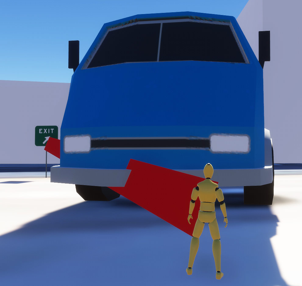
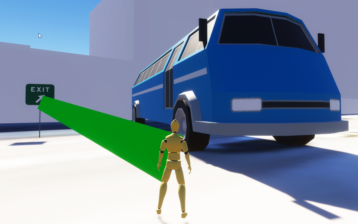
The sign viewshed simulation was developed as a tool for emergency planners to determine where signs used during emergencies should be placed in order that they can be seen when auditory warnings such as loud speakers are not an option for the deaf and hard-of-hearing. In the simulation, an avatar can walk around in urban environment. When they can see an emergency sign, a green line will emanate from the avatar. When they're in proximity of a sign that they cannot see, a red line will emanate from the avatar. This tool was built using the ArcGIS Maps SDK for Unity.

Sign Viewshed Simulation Demo - Avatar cannot see exit sign due being blocked by a truck as shown with red line.

Sign Viewshed Simulation Demo - Avatar can see exit sign truck as shown with green line.
A demonstration of the tool can be downloaded from this link.
DHH Population and Hazardous Events in Monroe County NY - Machine Learning Overview
This story map outlines machine learning analytics that were developed in Stage 1 for analyzing deaf and hard-of-hearing populations in relation to hazard events in Monroe County. The story map is an excellent resource for understanding how to use various methodologies to conduct such an analysis and includes several lines of Python source code that can be used for research.

The story map can be viewed from this link.
We are actively seeking project partners.
If you are a civil, government, private sector or other organization or individual interested in working with us on issues related to the Deaf and Hard-of-Hearing and Emergency Management, please contact Brian Tomaszewski.
For more information about the the NSF CIVIC program, visit: the NSF Civic Innovation Challenge Webpage.

This research funded through a grant from the US National Science Foundation and the project CIVIC-PG Track B: Bridging the Gap between Essential Emergency Resources and Services and the Deaf and Hard of Hearing Community in Monroe County NY: A Geospatial-Visual Approach (Award #2228522).

