James Albano
Researcher/Engineer II
Chester F. Carlson Center for Imaging Science
College of Science
585-475-7196
Office Location
James Albano
Researcher/Engineer II
Chester F. Carlson Center for Imaging Science
College of Science
585-475-7196
Currently Teaching
IMGS-617
Image Processing and Discrete Fourier Methods
2 Credits
This course considers sampled and quantized images and temporal image sequences, along with methods for performing useful image processing. These processing methods are classified based on the number of input picture elements (“pixels”) that determine the value of each output pixel: single pixels, local neighborhoods, or global operations. The discrete Fourier transform is introduced. Application to image segmentation and compression are considered.
IMGS-732
Synthetic Aperture Radar Image Formation Processing
3 Credits
This course covers the history and fundamental principles of synthetic aperture radar image formation processing (SAR-IFP). Topics included a review of linear systems theory, an introduction to radar systems, synthetic aperture radar (SAR) concepts, exposure to commonly used spotlight and stripmap image formation algorithms, and autofocus. The course concludes with a discussion on linear frequency modulated continuous wave (LFM-CW) SAR systems that are often fielded on very small, low-cost, low power platforms. Spotlight mode image formation algorithms covered in this course include the Polar Formatting Algorithm (PFA) and the Backprojection Algorithm. Stripmap mode image formation algorithms addressed include the Range-Doppler Algorithm and the Omega-K Algorithm. Along the way, a variety of remote sensing and linear systems theory will be employed to provide specific insight into the following system performance metrics: image size, area rate, resolution, impulse response, noise equivalent backscatter coefficient, residual quadratic phase error, depth of focus, and geometric distortion.
IMGS-789
Graduate Special Topics
1 - 3 Credits
This is a graduate-level course on a topic that is not part of the formal curriculum. This course is structured as an ordinary course and has specific prerequisites, contact hours, and examination procedures.
IMGS-799
Imaging Science Independent Study
1 - 4 Credits
This course is a faculty-directed tutorial of appropriate topics that are not part of the formal curriculum. The level of study is appropriate for student in their graduate studies.
In the News
-
October 11, 2022

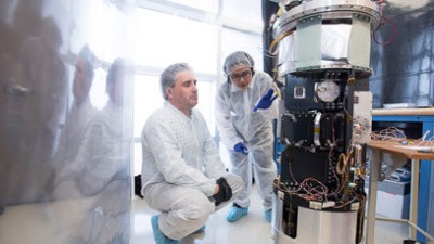
RIT researcher receives Department of Energy grant to develop synthetic aperture radar technology
James Albano, a researcher/engineer at RIT’s Chester F. Carlson Center for Imaging Science, has launched a project funded by the Department of Energy to develop remote sensing technology that could have applications ranging from assessing earthquake damage to determining soil moisture for predicting crop yield.


