RIT researchers study ‘prescribed fires’
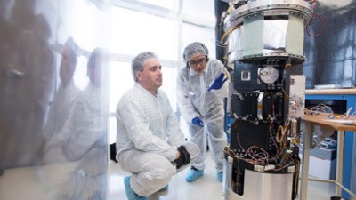
Bob Kremens and Jason Faulring participate in prescribed fire research experiments
Bob Kremens
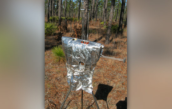
An army of 10 “flux packages” withstood intense heat last month during the Prescribed Fire Combustion and Atmospheric Research Experiment at Eglin Air Force Base in Florida. The instruments measure air temperature and radiant and total energy flux fluid flow in three dimensions. All the electronics and mechanical components were designed and built at RIT by Bob Kremens, research associate professor in the Chester F. Carlson Center for Imaging Science, and his students for the U.S. Forest Service Rocky Mountain Research Laboratory.
Studying fires is akin to studying tigers. After all, how close can one get?
Actually, a lot closer than you might think. RIT physicist Bob Kremens can “read” a fire without risking his life or singeing his eyebrows. He uses thermal infrared sensors on the ground to go deep inside a blaze. For a different perspective, RIT engineer Jason Faulring operates the RIT-built WASP (Wildfire Airborne Sensor Program) multispectral camera from a small aircraft to capture scenes beyond any bird’s eye view.
Kremens and Faulring are veterans of the fire research program that has grown over the last decade in RIT’s Chester F. Carlson Center for Imaging Science. They both are firefighters and regular participants in prescribed burns. The U.S. Forest Service uses controlled fires to reintroduce natural burn cycles into regional ecosystems and to study the physics of fire.
Not all fires are the same. How a fire unfolds depends upon a host of physical parameters—heat release, or where it goes and how the energy moves around—temperatures and smoke emission, and the effect of wind and materials consumed, among other variables. Prescribed burns help firefighters and scientists advance fire science in relative safety.
This year, Kremens and Faulring will join their Canadian colleagues for a prescribed burn at Yoho National Park near Golden, British Columbia, on the western range of the Rocky Mountains. Last month, the pair participated in the 2011 Prescribed Fire Combustion and Atmospheric Research Experiment, also known as Rx–CADRE, in the southern pines at Eglin Air Force Base near Niceville, Fla. Nearly 130 scientists and staff who attended the prescribed burns represented the U.S. Air Force, U.S. Forest Service, NASA Goddard Space Center, Los Alamos National Laboratory, Environmental Protection Agency, the Strategic Environmental Research and Development Program, Joseph W. Jones Ecological Research Center, the Nature Conservancy and the Association for Unmanned Vehicle Systems International.
In addition to RIT, participating universities included the University of Montana, Washington State University, Georgia Tech and University of California at Santa Cruz.
“RIT designed, built, and constructed nearly a hundred ground instruments—more than half of the instruments used in the fire,” says Kremens, research associate professor in the Digital Imaging and Remote Sensing Laboratory. “To our knowledge, this was the most well instrumented and characterized wildland fire event ever studied.”
RIT provided four different reusable instrument types:
Fire behavior package—initially built for the Rocky Mountain Research Station and the Missoula Fire Lab, “measures mass flow (wind), radiant and total energy released viewing ‘side-on’ in the fire,” Kremens says.
Mini-radiometers—measure a fire’s upwelled radiant energy and both calibrate the aircraft and provide high spatio-temporal resolution in-fire information
Standard plot fluxmeter—serves as a reference point for judging anticipated fire behavior
Plume position cameras—measure the height of the plume of smoke and the rate of change in height
“We came away with a tremendous amount of data,” Kremens says. “One initial positive conclusion was that this sort of complex experiment could be done successfully.”
Adds Faulring: “We orbited the fires every four minutes, from ignition until the major flaming combustion had completed or our plane ran low on gas. We ended up acquiring about 60 to 70 ‘looks’ at the progress of the burn.”
The sequence of shots creates a movie of the fire behavior.
“Every frame is a different pass over the fire, so you can see it growing and getting bigger. We use the data to verify prediction codes, an overhead picture or a map of how the fire might spread.”
Developing fire propagation codes is an active area of research, and a benchmark is needed to ensure accuracy in predicting fire behavior.
“This is the benchmark,” Kremens says. “This is what the fire actually did. We know where it was, we know what the fuels were and we know what the wind was because we had instruments in the fire. We calibrated everything.”


