RIT joins Property Drone Consortium
RIT research will enhance drones for insurance and construction industries
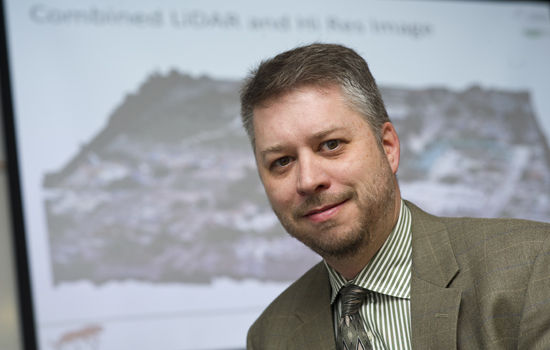
David Messinger, director of RIT’s Chester F. Carlson Center for Imaging Science
Rochester Institute of Technology was named a technology member of the Property Drone Consortium, a collaboration of insurance carriers, construction industry leaders and supporting enterprises.
The organization promotes research, development, the establishment of regulations and comments on standards for the commercial use of unmanned aircraft systems across the insurance and construction industries. Research focuses on collecting and processing images for inspection and damage detection of building exteriors as well as safety initiatives like collision avoidance and automated flight planning.
The Property Drone Consortium is led by Gary Sullivan, chairman, and Charles Mondello, president. Charter members include Allstate Corp., American Family Insurance, Auto Owners Insurance, Erie Insurance, EagleView Technologies Inc. and Pilot Catastrophe Services. The Insurance Institute for Business & Home Safety serves as technology adviser and the National Roofing Contractors Association is an honorary member of the collaboration.
RIT is currently the only university in the consortium. The affiliation could lead to funding for graduate students to work on problems of interest to the consortium, said David Messinger, director of RIT’s Chester F. Carlson Center for Imaging Science. He anticipates research opportunities that focus on roof inspections.
“Using drones allows a level of access to the roof that you can’t get from a typical manned aircraft or satellite,” Messinger said. “It’s a challenging problem because you’re talking about identifying sometimes fairly subtle damage that could still cause leaks and other problems, and damage caused by a storm versus natural aging or fraud.”
The imaging technology also stands to increase the efficiency of resolving insurance claims, notes Don McKeown, distinguished researcher in RIT’s Center for Imaging Science.
“Advanced automated image-processing algorithms will greatly improve the accuracy of damage assessment and accelerate the settlement of claims for consumers,” McKeown said.
Clearing other technological hurdles will enable drones to maneuver safely around gabled windows, air conditioning units and other roof-top obstacles, he said.
Replacing dangerous and manual roof inspections with enhanced unmanned aerial vehicles could lead to a number of related uses for drones.
“The same sort of technology could be applicable to different things like infrastructure monitoring—inspecting bridges and wind turbines, for instance,” Messinger said.
RIT recently named remote sensing with unmanned aerial vehicles as a signature research initiative at the university. The interdisciplinary program, based in the Chester F. Carlson Center for Imaging Science, will receive $1 million over the next five years to work on challenges facing this industry from integrating UAVs into the national airspace to making use of imaging data collected with sensors that read visual, spectral, thermal or spatial information.
The Unmanned Aerial Systems Center at RIT will act as a “technology bridge” between industries that use drones and those that provide the technology, Messinger said.


